
How to Create Flow Direction and Flow Accumulation in ArcGIS Pro Using DEM
🛍️ Products Mentioned (2)
#ArcGISPro #FlowDirection #FlowAccumulation #DEM #HydrologyGIS #SurfaceRunoff #WatershedAnalysis Learn how to generate flow direction and flow accumulation maps in ArcGIS Pro using a DEM in this step-by-step tutorial. We cover preparing your DEM, filling sinks, running the Flow Direction tool, and creating Flow Accumulation to identify drainage patterns and stream networks. You'll see tips on setting proper cell size. Ideal for hydrologists, GIS students, and environmental professionals who need to model surface runoff, map drainage basins, or prepare inputs for stream network extraction and flood modeling. Buy me a coffee here: https://buymeacoffee.com/geojay For business and enquiries: WhatsApp+2347065365193 or Email: geojaygis@gmail.com WhatsApp Group: https://chat.whatsapp.com/CvvLBo7YisgIClQgzL7WOa Facebook Group: https://www.facebook.com/share/g/1Fn4oQzn1L/ Flow Direction, Flow Accumulation, ArcGIS Pro, DEM, Digital Elevation Model, Hydrology, Watershed Analysis, Drainage Network, Surface Runoff, Terrain Analysis, Fill Sinks, Sink Filling, Raster Hydrology, Stream Network Extraction, Flow Direction Tool, Flow Accumulation Tool, Flow Routing, GIS Hydrology, Hydrologic Modeling, ArcGIS Tutorial, GIS Tutorial, Spatial Analysis, Flow Path, Stream Extraction, Pour Points, Watershed Delineation, Flow Direction Raster, Accumulation Raster, Cell Size, NoData Handling, DEM Preprocessing, Pit Removal, Flow Grid, D8 Algorithm, D-Infinity, Multiple Flow Direction, MFD, D8 Flow Direction, Stream Order, Strahler Order, Horton Order, Channel Network, Flow Accumulation Threshold, Stream Thresholding, Raster Reclassification, Map Algebra, ArcPy, Python for GIS, ModelBuilder, Automate Workflow, Batch Processing, High Resolution DEM, LiDAR DEM, SRTM Data, ASTER DEM, TopoDEM, Terrain Derivatives, Slope Map, Aspect Map, Hillshade, Topographic Index, TWI, Topographic Wetness Index, Flow Convergence, Watershed Boundary, Catchment Area, Basin Delineation, DEM Smoothing, Resampling DEM, Reprojection, Coordinate System, Hydrologic Tools, Spatial Analyst, ArcGIS Spatial Analyst, Toolboxes, Geoprocessing, GIS Workflow, Field Hydrology, Flood Modeling, Flood Risk, Erosion Modeling, Soil Erosion, Sediment Transport, Runoff Modeling, Surface Water Modeling, Drainage Density, Stream Density, Channel Initiation, DEM Voids, Data Preparation, Data Cleaning, Raster Calculator, Conditional Statements, Extract by Mask, Clip Raster, Merge Rasters, Mosaic DEM, DEM Tiling, Edge Effects, Flow Accumulation Visualization, Vectorization, Raster to Vector, Convert Raster to Polyline, Stream Links, Stream Segments, Network Analysis, Hydrography, HydroBASINS, Hydrologic Conditioning, Burn-in Streams, Stream Burning, DEM Conditioning, Preprocessing Tips, Best Practices, GIS Education, University Lab, Research Methods, Environmental Modeling, Watershed Management, Catchment Analysis, Stormwater Modeling, Urban Hydrology, Rural Watersheds, Agricultural Runoff, Conservation Planning, Infrastructure Planning, Drainage Design, Floodplain Mapping, Channel Mapping, River Network, Coastal Watersheds, Mountain Hydrology, Catchment Delineation, DEM Resolution, Vertical Accuracy, Horizontal Accuracy, Data Sources, Open Data DEM, National Elevation Dataset, USGS DEM, Global DEM, Shuttle Radar, LiDAR Point Clouds, Point to Raster, Interpolation Methods, IDW, Kriging, Spline, Triangulation, TIN to Raster, Hydrological Conditioning Tools, Step-by-step Guide, Hands-on Tutorial, Practice Data, Sample Dataset, Downloadable Data, Screen Recording, Voiceover Tutorial, Quick Tips, Time-saving Tricks, Troubleshooting, Common Errors, No Flow Direction, Flat Areas Handling, Flat Resolution, Flat Remediation, Outlet Points, Pour Point Processing, Snap Pour Points, Snap Distance, Accumulation Threshold Selection, Channel Extraction, Drainage Hierarchy, Hydro-Enforcement, Snowmelt Runoff, Rainfall-runoff, Event-based Modeling, Continuous Modeling, HEC-HMS Integration, SWAT Integration, Flood Inundation, DEM-derived Features, Contour Lines, Cross-section Analysis, Flowline Mapping, GIS Cartography, Map Styling, Symbology for Streams, Color Ramps, Legend Design, Map Export, Print Layout, Geographic Information Systems, Remote Sensing Integration, Land Cover Influence, Impervious Surfaces, Urban Flooding, Infrastructure Vulnerability, Environmental Impact Assessment, Watershed Health, Riparian Zones, Streambank Erosion, Restoration Planning, Hydrologic Connectivity, Surface Flow Paths, Groundwater Interaction, Baseflow Separation, Hydroinformatics, Data Processing Pipeline, Parallel Processing, High Performance Computing, Large DEM Handling, Memory Management, Cloud Processing, Google Earth Engine, QGIS Hydrology Tools, GRASS GIS r.watershed, Open Source Alternatives, Comparative Tools, Version Control, Reproducible Workflows, Documentation, Metadata, Citation, Licensing, Esri Resources, Community Forum, GIS Stack Exchange, Continuing Education
About This Video
Frequently Asked Questions
🎬 More from Geojay GIS Solution
How to extract Elevation point data for any location Using Google Earth Pro + GPS Visualizer + QGIS
26 views
How to download and install ALOHA Software: Areal Locations Of Hazardous Atmospheres on your PC
22 views
How to Replace Study Area in a Script in Google Earth Engine
25 views

Download and install Original Office Professional 2021 for Windows in 2026 in Less than 4 Minutes
96 views
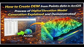
How to Create DEM from Point data in ArcGIS: Process of Digital Elevation Model Generation Explained
29 views
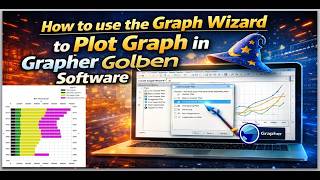
How to use the Graph Wizard to Plot Graph in Grapher Golden Software
21 views