
Download High Resolution DEM 12.5m for FREE fo any Location
🛍️ Products Mentioned (2)
#DEM12m #FreeDEMDownload #HighResolutionDEM #GlobalDEM #TerrainData #DigitalElevationModel #GISResources Looking for high-resolution elevation data for your GIS or mapping projects? In this video I show how to download a 12.5 m DEM for any location completely free. You’ll learn step-by-step methods to find, select, and save the DEM tiles, plus tips for clipping to your area of interest, reprojecting, and preparing the raster for analysis in QGIS, ArcGIS, or Google Earth Engine. I also cover common pitfalls, file formats to use, and quick checks to verify data quality. Whether you’re working on hydrology, terrain analysis, flood modelling, or visualization, this tutorial will get you started fast. Don’t forget to like and subscribe for more GIS tutorials! Buy me a coffee here: https://buymeacoffee.com/geojay For business and enquiries: WhatsApp+2347065365193 or Email: geojaygis@gmail.com WhatsApp Group: https://chat.whatsapp.com/CvvLBo7YisgIClQgzL7WOa Facebook Group: https://www.facebook.com/share/g/1Fn4oQzn1L/ DEM, DEM download, Digital Elevation Model, 12.5m DEM, high resolution DEM, free DEM, free elevation data, download DEM, global DEM, terrain data, elevation data, topography, topographic data, DEM 12.5m, SRTM alternative, ALOS DEM, ASTER DEM, COPERNICUS DEM, DEM tiles, DEM download tutorial, DEM for QGIS, DEM for ArcGIS, DEM for Google Earth Engine, DEM processing, DEM clipping, DEM reproject, DEM raster, DEM analysis, hillshade creation, contour generation, elevation model, terrain model, LiDAR alternative, open source DEM, free GIS data, GIS DEM, remote sensing, elevation map, DEM for hydrology, flood modelling DEM, watershed analysis DEM, terrain visualization, 3D terrain, DEM workflow, how to download DEM, where to get DEM, high-res elevation, DEM for mapping, DEM tips, DEM troubleshooting, DEM file formats, GeoTIFF DEM, DEM GeoTIFF, DEM download site, DEM sources, DEM datasets, elevation DEM, SRTM 1 arc-second, 30m to 12.5m DEM, DEM upscaling, DEM resampling, DEM mosaicking, DEM tiles download, DEM global coverage, DEM quality check, DEM accuracy, elevation contours from DEM, DEM slope aspect, DEM derivatives, creating hillshade, QGIS hillshade, ArcGIS hillshade, Google Earth Engine DEM, Python DEM processing, GDAL DEM tutorial, ogr2ogr DEM, gdalwarp DEM, gdal_translate DEM, DEM projection, DEM coordinate system, DEM EPSG, DEM for 3D printing, DEM for game dev, DEM for architecture, DEM for civil engineering, DEM for urban planning, DEM for agriculture, DEM for forestry, DEM for environmental studies, DEM for geology, DEM for disaster management, DEM for infrastructure, DEM for surveying, DEM for researchers, DEM for students, free GIS resources, open data DEM, open DEM download, DEM download free site, DEM download guide, DEM step by step, DEM beginner tutorial, DEM advanced tutorial, DEM tips and tricks, DEM best practices, DEM metadata, DEM elevation units, meter elevation, DEM vertical datum, DEM horizontal datum, DEM seamless, DEM clipping to AOI, area of interest DEM, AOI DEM, DEM export, DEM import, DEM licensing, DEM public domain, creative commons DEM, DEM for offline use, DEM for mobile GIS, DEM for web mapping, DEM web tiles, DEM Tile Map Service, DEM caching, DEM performance, DEM storage optimization, DEM compression, DEM tools, DEM software, QGIS DEM plugin, ArcGIS DEM tools, GRASS GIS DEM, WhiteboxTools DEM, DEM in R, terrainR package, GDAL DEM functions, DEM color relief, DEM shaded relief, DEM visualization techniques, DEM cartography, DEM map design, DEM basemap, DEM overlay, DEM contour interval, DEM spot elevation, DEM smoothing, DEM filtering, DEM sink filling, DEM hydrologic conditioning, DEM flow accumulation, DEM stream network extraction, DEM flood inundation modeling, DEM for coastal studies, DEM for shoreline mapping, DEM for landslide analysis, DEM for slope stability, DEM for catchment delineation, DEM for erosion modeling, DEM for sediment transport, DEM for groundwater studies, DEM for climate modeling, DEM for solar radiation analysis, DEM for line of sight, viewshed analysis DEM, DEM for route planning, DEM for slope mapping, DEM for slope classification, DEM for aspect mapping, DEM for terrain ruggedness index, DEM for topographic wetness index, DEM for agricultural suitability, DEM for land suitability analysis, download elevation model, free high resolution DEM, 12.5 meter DEM free, 12.5 m elevation data, 12.5m raster DEM, 12.5m GeoTIFF, high res DEM download tutorial, download DEM anywhere, DEM for any location, global high-res DEM, free terrain model, free topography download, free elevation raster, free digital terrain model, DTM download, DSM vs DTM, DEM vs DSM, DEM resources online, DEM links, DEM repositories, DEM portals, DEM catalogs, DEM dataset links
About This Video
Frequently Asked Questions
🎬 More from Geojay GIS Solution
How to extract Elevation point data for any location Using Google Earth Pro + GPS Visualizer + QGIS
26 views
How to download and install ALOHA Software: Areal Locations Of Hazardous Atmospheres on your PC
22 views
How to Replace Study Area in a Script in Google Earth Engine
25 views

Download and install Original Office Professional 2021 for Windows in 2026 in Less than 4 Minutes
96 views
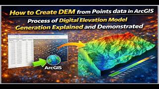
How to Create DEM from Point data in ArcGIS: Process of Digital Elevation Model Generation Explained
29 views
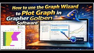
How to use the Graph Wizard to Plot Graph in Grapher Golden Software
21 views