
This Storm Train Will Cause SERIOUS Problems...
🛍️ Products Mentioned (7)
Keep your family safe with MaxAlert this severe weather season

brand new WEATHER website

Shopmaxvelocity Product

All Social Links
Cameo

Discord

This forecast may include graphics from PivotalWeather
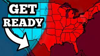
In this video, we are talking about a HUGE weather pattern shift that will lead to a dangerous train of storms over the next 7 days! Severe weather is possible on Thursday, with damaging winds, large hail, and a few tornadoes possible. Additionally, snow could make ANOTHER return to the Midwest, Ohio Valley, and Northeast over the next several days. With a record-breaking heatwave ongoing, this is setting up for quite the active stretch of weather. Get the latest details in this forecast! NEW WEBSITE: https://www.maxvelocitywx.com/ 0:00 - Intro 0:37 - Weather 10:41 - HUGE ANNOUNCEMENT! Get all of your weather forecasts on our website: https://www.maxvelocitywx.com/ Join my channel to access exclusive perks: https://www.youtube.com/channel/UCvBVK2ymNzPLRJrgip2GeQQ/join Grab some Max Velocity Merch: http://shopmaxvelocity.net/ Keep your family safe with MaxAlert this severe weather season: https://maxalert.net/ Send Fan Mail Here: Max Velocity 3275 S John Young Parkway STE 641 Kissimmee, FL 34746 United States Follow me on other platforms: All Social Links - https://linktr.ee/maxvelocity Website - https://www.maxvelocitywx.com/ Facebook - https://www.facebook.com/maxvelocitywx/ Twitter -- https://twitter.com/maxvelocitywx Discord - https://discord.gg/pAWZG8wz6n Instagram - https://www.instagram.com/maxvelocitywx TikTok - https://www.tiktok.com/@maxvelocitywx Second Channel - https://www.youtube.com/@MoreMaxVelocity Other links: Cameo - https://www.cameo.com/maxvelocitywx All Other Links - https://linktr.ee/maxvelocity Business Inquiries: maxvelocitywx@gmail.com Max Velocity is a degreed meteorologist and covers extreme severe weather, tropical storms, hurricanes, and wintry weather in the United States. Max Velocity has over 2,000,000 followers across all social media platforms and is well-known for providing accurate and honest weather forecasts. Max Velocity can be found on YouTube, Facebook, TikTok, Twitter, and Instagram. All of our social media are linked above. This forecast may include graphics from PivotalWeather: https://home.pivotalweather.com/ #severeweather #severestorms #weatherchannel #winter #snow #news #weather #weatherforecast #forecast #snowstorm #winterstorm
About This Video
Frequently Asked Questions
🎬 More from Max Velocity - Severe Weather Center
🔴 BREAKING SEVERE WEATHER OUTBREAK COVERAGE - Large Tornadoes Possible With LIVE Storm Chasers...
666.7K views
This New Forecast Just Got Worse...
251.0K views

This Storm Just Took A STRANGE Turn...
351.6K views
This Storm Is About To Cause SERIOUS Problems...
255.0K views
Severe Storms Are About To Explode...
225.0K views
An INSANE Severe Weather Pattern Is Coming...
253.8K views