
Interesting place this !
🛍️ Products Mentioned (3)
Walk along the Bedar mining route in Almeria, southern Spain. 11km exploring the old mine ruins, caves and history of the area using my DJI Mavic Air and Osmo Action camera. The walk took us 4 hours with stops and is not too difficult even with children. Hi, Richard Fiske here, Welcome to my "Droning Around " channel. By subscribing to my YouTube channel, you are supporting my content, so a big thank you! https://bit.ly/4oAlJxX Buy your gear with these links:- DJI Mavic Air 2 drone: https://click.dji.com/AKSWDXp_QF1B03sGPzH72A?pm=link DJI Osmo Action Cam: https://amzn.to/2NZSxUU The hills and valleys surrounding Bédar are studded with the ruins of mine workings. Some of the mines were one-man affairs, with his pick and shovel. Others were owned by corporations that shared the costs of the infrastructure that allowed more efficient extraction and transportation of the ore. The landscape is dotted with the remains of that infrastructure from narrow gauge railway tunnels to pillars that once supported the cables of the aerial cableways that took ore out of the mountains, down to the main railway line, or one notable exception, from Bédar all the way to Garrucha, the longest aerial cableway in Spain. This walk is through a mining landscape that was alive during the last part of the 19th century and the first half of the 20th. It is well marked with wooden posts marked SL-A 77 with green and white stripes. Cargadero Tres Amigos The walk starts on the AL 6109, 1.5 kilometres south of Bédar. You will see a stone-built structure to the left, set back from the road. Ore from the mountains arrived at the Cargadero Tres Amigos by a combination of methods, via narrow gauge railway, aerial cableway and donkey cart and loaded into hoppers. Trains hauling ore wagons would roll into the cargadero. Chutes from the hoppers delivered the ore into the wagons. From there it trundled off on a narrow-gauge railway to the blast furnaces at Garrucha. Park near the cargadero head up the hill to the top on to the level section. This is the route of the narrow-gauge railway line that went all the way up the valley to the Santa Catalina mine. The Mina Pobreza ruins on the left-hand slope of the valley started operations in 1871. It employed fewer than 20 people and extracted less than 30,000 tons of iron ore per year in the form of goethite, siderite and hematite. It was worked until 1970. Túnel del Servalico We soon reach the 200 metre long Túnel del Servalico. Walk through the tunnel. About halfway down, on the right is the chute that led to the tiny Mina Alerta on the hill above, down which the miners could shovel the ore directly into the ore wagons below. San Manuel Mine After the tunnel and walk on the marked path. You will emerge in the Baeza Barranco with fantastic views of the ravine and San Manuel mine, far below. This was an open cast mine that has an impressive list of minerals attached to it: lead oxide, iron carbonate, barium sulphate, lead carbonate, bournonite lead, copper and sulphur, iron tungstate, zinc sulphide, potassium iron sulphate, copper carbonate hydroxide, copper carbonate hydroxide, quartz and native silver. The minerals were taken almost 20 kilometres to Garrucha via an aerial cable, the longest in Spain. Via Vulcana From the San Manuel mine bear right and take the short tunnel. You emerge in a landscape of boulders and raw outcrops. At some time during the mining operations this section, a confluence of several mine adits, has collapsed. It may also have been caused by uncontrolled blasting. The Spanish had a laissez-faire attitude. It was customary for the fuse to be lit at any time of day or night. A cry of ‘fuego en el hoyo’ sent everybody within hearing scampering for a safe place before the charge exploded. Barranco de los Lobos Via Vulcana deteriorates into a narrow path on the side of the steep hill with a fair drop on the left so be a bit careful. Wooden sleepers underfoot tell us we are still on the narrow gauge railway line although part has washed down into the barranco below. Two shorter tunnels take you to another set of hoppers that fed ore from the Vulcana mine to the rail line. The route then crosses the Barranco de los Lobos on a narrow bridge that has guard ropes. Hoyo Jupiter Carry straight on as the path winds up the hill. You come to a sign, ‘Hoyo Jupiter’ pointing off to the right. After a few metres you find yourself on the upper edge of a huge chasm, the Jupiter Mine. This mine was very productive and at its height, it employed 850 people and produced (in 1895) 17,500 tons of iron ore per year. There were six individual mines in total. It was worked until 1972. Notice the striking colours of the exposed rock from deep rusty red to the crisp white of dolomite. Music from Inspirational Music Channel: https://www.youtube.com/channel/UC8AFhmK0278NQVL1sJefhFQ?sub_confirmation=1
🎬 More from Richard Fiske
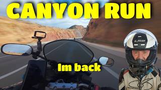
Spanish Canyon Run
75 views
Secret Disneyland Castle with GIANT WWII Guns in Spain
95 views

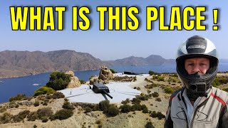
Searching for Indianas Beach - Can we find it ?
83 views
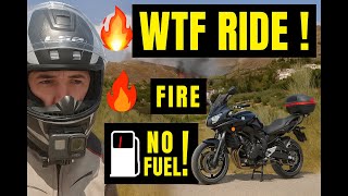
Motorcycle Mistake Turns Into CHAOS – No Fuel, Fire & Sticking Throttle
231 views

Near Miss, Epic Roads & Turquoise Lakes – Andalucía Motorcycle Adventure!
439 views

Epic Motorcycle Rideout Through Spain’s Hidden Mountain Roads!
148 views