
The Road to Chirico Trail: Navigating the Issaquah Alps
🛍️ Products Mentioned (4)
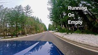
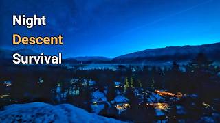
A freak late March snowstorm completely transformed the Issaquah Alps, turning a standard approach to Poo Poo Point into a tense, atmospheric winter drive. Navigating the slick, slush-covered roads outside of Seattle requires focus when you are without traction gear. This scenic drive captures the stark transition from damp suburban streets to the deep, silent, snow-caked Douglas firs and cedars of West Tiger Mountain. With a hood-mounted perspective and live telemetry data, watch the elevation gain and temperature drop as the route winds deeper into the high-altitude forest. The destination is the staging area for the Chirico Trail, a notoriously steep path that gains 1,700 feet of elevation in under two miles. Originally a historic logging site for the Weyerhaeuser Corporation, the peak now serves as a premier paragliding launchpad. Once the car is parked, the real challenge begins: leaving the heater behind to tackle a grueling vertical ascent through fresh powder. Thanks for watching, and make sure to join us on our next adventure! SOCIAL: TWITTER: https://twitter.com/adventurewithbg INSTAGRAM: https://instagram.com/adventureswithbg FACEBOOK: https://facebook.com/adventureswithbg BLOG: http://adventureswithbg.com Music Credits: Snowfall by Scott Buckley | https://soundcloud.com/scottbuckley Undertow by Scott Buckley | https://soundcloud.com/scottbuckley Royalty Free Music by https://www.free-stock-music.com Creative Commons / Attribution 4.0 International (CC BY 4.0) https://creativecommons.org/licenses/by/4.0/ #issaquahalps #poopoopoint #washingtonstate #scenicdrive #winterdriving #pnw #pacificnorthwest #chiricotrail #tigermountain
🎬 More from Adventures With BeeGee
Between the Climbs: The Heavy Drive to Rattlesnake Ledge
26 views
Texas Morning Nature Sounds
65 views
The Secret Trail Built Just to Jump Off a Mountain
84 views
Texas Background Nature Sounds
63 views
The Brutal Reality of Climbing Little Si in the Ice
79 views

Snowy Drive Thru Snoqualmie Valley to Little Si Mountain
89 views