Is this your channel?
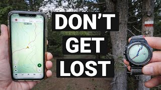
Gaia GPS
Gaia GPS
I’ve used Gaia GPS for the past four years and I still think it’s the best overall option. The maps load fast, they’re detailed without being too cluttered, and you can even make the free version work offline by caching tiles (just test it in airplane mode).
Buy on Gaiagps
You'll be taken to Gaiagps to complete your purchase.
Pros
- +Fast-loading maps that are detailed but not overly cluttered
- +Works well for GPX navigation
- +Free version can work offline via map-tile caching
- +Good for building custom routes on a computer
Cons
- -Paid version price increased to about $60/year
- -Caching tiles is theoretically riskier than true offline downloads
What Oscar Hikes says
“com if if you or your friend has finished a hike that you're proud of our posters will help you remember this adventure as of right now on our website we have posters for over 170 different hiking trails and right now is a really good time to do that because in addition to the regular 10% discount that you'll get with the discount code Oscar hikes we're running another sale until the 10th of December that will get you another 10% off thank you for not skipping and now let's get back to the video I've used Gaia GPS for the past 4 years and even in 2024 I still think it's the best option because their Maps load very quickly they're very detailed but at the same time they aren't too cluttered if you don't want to pay anything for a hiking app then it's totally doable with the free version of Gia GPS while you're still at home simply import the GPX file on the app you'll now see the whole route that you're planning to do now zoom into at least 100 m scale and then start following the whole route this will automatically download all the map tiles in your phone's cache which means that the next time that you lose your internet connection you'll still be able to see all the areas where you zoomed in previously but before you go out hiking you need to make sure that it works so turn on airplane mode restart the app and then double check that you're still able to see all the areas without any internet connection honestly I've done this for the past 4 years and this has never fail me but I do agree that this is a bit risky because theoretically your phone's cash could be deleted at any time so a more reliable option would be to download offline maps for specific areas but this is usually available only on paid hiking apps for a paid hiking app I would still recommend Gaia GPS however they did recently increase their prices and now they cost $60 per year which is quite a lot so I started looking for Alternatives and I only found one which is called goat Maps which cost $30 per year I've been testing their app for the past month now and I think it's almost as good as Gaia and in some aspects even better the only downside to them is that currently while they're still new they only have a version for iOS which means means no Android and also no web version I like to plan my own custom routes on my PC because of a larger screen and for that I recommend two websites ctpo and Gaia GPS with Gaia GPS being my preference to do that you simply need to click on the root section on the left side and then start clicking on the map and the route will automatically snap to the trails or roads one thing that I think is extremely helpful here is to turn on the 3D mode which allows you to visualize the Trin a bit better when you're you're finished it will show you exactly how long the hike will be and exactly with what kind of elevation gain when you look at a topographic map it will always have contour lines which are really really useful for hiking the parts where the contour lines are very close together are very steep which means that the trail is probably going to be really difficult sometimes it's easier to do a slightly longer route if it avoids these steep sections in places where these contour lines are very far from each other the terrain is more flat and this is really useful for finding potential places where you can set up your tent another important thing to watch out for is the tree cover these dark green areas because it's also useful for finding places where to set up your tent another tip is not only to look at the topographic maps but also cross check them via satellite because sometimes not all trails and roads are marked on the topographic map sometimes it may seem like you could just take a shortcut which would be faster however I wouldn't recommend that from my own experience usually the shortcut takes longer and is more dangerous because it's too overgrown or too Steep and my last tip is to watch out for and learn how to recognize important points of interest like water sources streams rivers and lakes mountain Huts Peaks mountain passes caves and other points of interest so essentially there are two options to choose from Personal Locator beacons and satellite messager devices personally I wouldn't recommend plbs or Personal Locator beacons because they only allow for one-way Communications essentially they only have a button that you can push and that's it satellite communicators on the other hand allow two-way communication which means that you can message anyone you can receive messages back from them and you can explain the situation for example if you just sprain your ankle you can message your wife or your friend and let them know that you'll probably be delayed and that you're fine and that you don't need a rescue one other important thing that I want to mention here is that now iPhone 14 and 15 users can use satellite messaging for free which essentially makes satellite messages useless however the problem is that right now they're only available in North America not Europe and also iPhone 14 and 15 is pretty expensive even if you're looking at a used one you're looking at A500 upgrade you should also get some kind of insurance for a rescue in the mountains because these can be incredibly expensive ranging between 10 to 50,000 for a heli rescue but luckily the insurance for this is pretty cheap at least here in Europe we have various Mountain clubs for example the Austrian Alpine club which has a yearly subscription of about €70 and it covers a rescue in the mountains anywhere in the world some other ones to look into are the German French and the Italian Alpine clubs and you also do not need to be a citizen of that country to get into these Mountain clubs anyway that's all I have to say about navigating if you have anything else to add please write that down in the video comments so that it helps out other people thank you for watching and I'll see you in one of my next videos see you”